
Castor Gardens began to take shape in the early 1900s, when farmland north of Oxford Circle was gradually divided and sold for residential use. Growth followed the expansion of transit routes along Castor Avenue and Roosevelt Boulevard, encouraging a suburban-style community within city limits. Builders introduced stone twins and brick rowhouses, which became the defining housing types of the neighborhood. Many of the first residents were second-generation immigrant families, including Jewish and German households, moving out of denser parts of North Philadelphia.
Between the 1930s and 1970s, Castor Gardens experienced a strong period of residential stability and expansion. After World War II, returning veterans and young families filled newly built blocks, especially north of Magee Avenue. The opening of Roosevelt Mall helped establish Castor Avenue as a major shopping and commercial corridor. Local schools, such as Castor Gardens Middle School, reinforced a sense of neighborhood identity. During this era, the population was largely Jewish, Irish, and Italian, reflecting broader patterns in Northeast Philadelphia.
From the 1970s onward, Castor Gardens evolved into a highly diverse community. By the 1990s and 2000s, the neighborhood included growing Asian, Latino, and African populations, while still maintaining a strong base of owner-occupied homes. Despite demographic changes, many blocks remained stable and closely knit. Commercial activity along Castor Avenue continued, supported by small businesses and periodic revitalization efforts. In recent years, green infrastructure and stormwater projects have been introduced, modernizing parts of the local streetscape and public realm.
The borders of Castor Gardens are not officially fixed, but several reference points are frequently mentioned. The neighborhood is generally described as being centered around Castor Avenue and Cottman Avenue, extending toward Whitaker Avenue and the vicinity of Roosevelt Boulevard. Some descriptions place Pennway Street near the southern edge and Cottman Avenue near the northern edge. Over time, Castor Gardens has often been discussed together with nearby Oxford Circle, reflecting how residents and real estate markets perceive the area as a connected district.
The lack of a single, official definition for Castor Gardens stems from overlapping neighborhood descriptions in city planning documents, real estate usage, and local conversation. Different sources outline slightly different borders, and many long-time residents casually refer to the combined area as “Oxford Circle–Castor.” Because the neighborhood developed in stages rather than as one unified project, its edges formed organically, contributing to the sense of fluid boundaries.
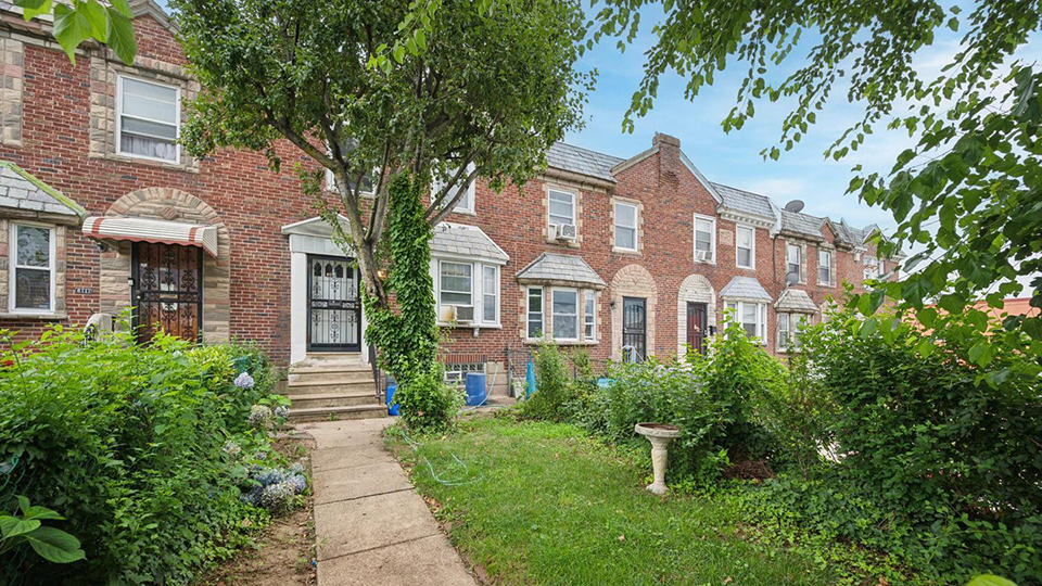
The housing stock in Castor Gardens reflects its layered development over the 20th century. Early streets feature stone-front twins on tree-lined blocks, while later phases introduced brick rowhouses with small front lawns and shared driveways. Post-war infill brought ranch homes and duplexes, especially farther from the original core. Together, these building types create a distinctly suburban feel within the city, which has long been a draw for homebuyers seeking space, yards, and a neighborhood identity.
Nearby Neighborhoods
Street Names
Algon Avenue • Bingham Street • Blee Street • Bleigh Avenue • Brous Avenue • Brous Court • Bustleton Avenue • Castor Avenue • Cottman Avenue • Cranford Street • Devereaux Avenue • Dorca Street • Englewood Street • Hartel Avemue • Kindred Street • Large Street • Levick Street • Levick Street • Loney Street • Loretto Avenue • Magee Avenue • Oxford Avenue • Pennway street • Princeton Avenue • Roosevelt Boulevard • Sanger Street • Shelbourne Street • Summerdale Avenue • Tyson Avenue • Whitaker Avenue