Site Index | New/Updated | Search | Contact
The Delaware and Raritan Canal
See also:
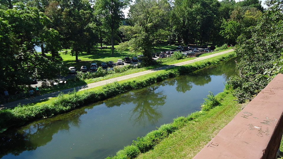
Photo: The Delaware and Raritan Canal, 2013, username: Tomwsulcer, photographer, wikipedia, public domain, accessed June, 2021.
Text below is adapted from The Delaware and Raritan Canal Site Analysis. Assessment of Condition and Proposed Mitigation Plan, a report prepared by Louis Berger & Associates, Inc. for the Federal Highway Administration and New Jersey Department of Transportation, dated June 1983.
Beginnings [†]
The idea of building a canal across New Jersey to link the Delaware and Raritan Rivers is said to have originated during the Colonial period but it was not until 1796, when the Assunpink Creek Navigation company was incorporated, that any action was taken towards realizing this notion (Madeira 1941:7). However, the Assunpink Creek Navigation Company apparently never carried out their plans for improving existing streams for navigation and linking them with canals. In 1816, a commission was set up to determine the most suitable route and to estimate the cost of construction. The route proposed at this time was virtually the same as the one eventually constructed, and the cost was estimated at $1,000,000. In the 1820s a charter was granted to the Delaware and Raritan Canal company by the New Jersey legislature but the company could not raise enough capital to begin construction. The charter was voided but between 1820 and 1830 further attempts were made to get the project off the ground. The route and cost were checked by Canvass White, one of the senior surveyors of the Erie Canal, who was appointed chief engineer of the Delaware and Raritan Canal in 1825. White confirmed the suitability of the alignment already proposed but revised the cost estimate upwards to almost $2,000,000 (Cawley and Cawley 1970; McKelvey 1975; Menzies 1976; Bastoni 1982).
Even at this early stage, public enthusiasm for the canal lagged behind that for the projected Camden and Amboy Railroad. Conflict between proponents of the canal and railroad came to a head in 1830 because of this rivalry, and the state legislature granted charters to both projects on the same day February 4, 1830. The Camden and Amboy Railroad sold all shares within minutes of authorization but the Delaware and Raritan Canal Company took some months to raise the necessary backing and only then through the infusion of funds by the wealthy Stockton family of Princeton. Nevertheless, the wariness with which each project regarded the other led in 1831 to the Camden and Amboy Railroad and the Delaware and Raritan Canal Company merging to form the "Joint Companies." This marriage of convenience included a clause preventing the construction of competitive lines of transportation across central New Jersey for thirty years. As a result, the Delaware and Raritan Canal was able to establish a sound and relatively unchallenged economic position which it maintained until the last quarter of the 19th century (Veit 1963; Menzies 1976).
Both canal and railroad began construction in the fall of 1830. Excavations for the canal were begun under Canvass White's supervision in both Trenton and Kingston, and the 14 mile long upper level of the canal between these two points was completed and opened to traffic in 1833. The full length of the canal was formally opened on June 25 of the following year.
When completed in 1834, the main line of the Delaware and Raritan Canal between Bordentown and New Brunswick extended 43 miles and included 14 locks. The feeder canal which tapped the Delaware River at Bulls Island and fed into the upper level of the main canal in Trenton extended 22 miles and passed through three locks. The Delaware and Raritan was essentially a contour canal, that is to say, it took the line of least resistance and followed the contours of the ground. The initial specifications called for a canal 50 feet wide by 5 feet deep; but this was soon changed to 75 feet wide by 7 feet deep. The dimensions of the feeder were also enlarged from 30 feet wide by 4 feet deep to 60 feet wide by 6 feet deep (Madeira 1941:31; Veit 1963:70).
A good description of the locks was given by Ashbel Welch in 1850, who described the canal as follows:
"This canal was built with fourteen locks; seven west of the summit overcoming an elevation of fifty-seven feet; and seven east of the summit, overcoming an elevation of fifty-eight feet. These locks are twenty-four feet wide, with a space of one hundred and ten feet between the gates, from point to point, and a total length of one hundred and sixty-five feet. The lock walls have cut faces, and are laid, like other masonry on the canal and feeder, with hydraulic cement" (quoted in McKelvey 1975:7).
A more contemporary (although less detailed) description was written in October 1833 when the canal was almost completed. In this, account the difference in elevation between Trenton and Bordentown is given as 58 feet "overcome... by seven locks; one at Trenton of seven feet; one at the state Penitentiary of seven feet; three at Lamberton of nine feet; one below Lamberton of seven feet; and one at Bordentown of 10 feet lift") Gordon 1834: 27-28).
In addition to the 14 locks on the main line there were 29 pivot bridges, 17 culverts and one aqueduct. On the feeder there were 37 pivot bridges and 15 culverts. Besides these features there were other structures such as lock keepers' houses, mule barns, log houses which enclosed the lock mechanisms, tool houses, bridge keepers' shanties, and canal basins (Gordon 1834:27-28; Madeira 1941:36).
The Delaware and Raritan appears to have been successful from an early date, primarily because of its value as a means of transporting coal from the anthracite coal fields of Pennsylvania to the developing industrial cities of the New York Bay area and Lower Delaware Valley. In 1846, 600 barges were in operation on the canal and by 1859 the number had increased to 1400. The existence of the "Joint Companies" undoubtedly protected the canal from competition and the increasing traffic on the waterway resulted in navigation improvements. In 1849 the canal company began to replace the upper lock gates on the main line with drop gates; in 1851 the depth of the canal was increased by dredging to eight feet; and in 1853 the length of the main line locks was increased to 220 feet and the canal banks were rip-rapped (Veit 1963:23; Cawley and Cawley 1970:34; McKelvey 1975:4-5). All these measures were designed to increase the efficiency of the canal. Drop gates were lighter and easier to operate than miter gates, and were an innovation first used by Canvass White on the Lehigh Canal in Pennsylvania which was completed in 1829 (HCRS 1981:10; Bastoni 1982:58). Dredging the canal made it possible for boats with greater draughts to use the waterway. Another major advantage was the decrease in resistance to the passage of boats when the prism of a canal was enlarged (Sweet 1880: 100) . The greater length of the locks allowed two boats (moving in the same direction) to be locked through at once and meant a considerable saving in time for the journey through the canal.
The greatest period of canal prosperity was between 1850 and 1875. The peak year for the canal before the Civil War was 1860 when a total of 1,639,997 tons of freight was transported through the waterway and the company paid a dividend of 12 percent. The busiest year of all time for the canal, however, was 1866 when 2,857,244 tons of freight were carried, of which 2,282,203 tons were anthracite coal (Madeira 1941:49, 51, 53-54; McKelvey 1975: 5). The success of the canal continued to stimulate rapid industrial growth in both Trenton and New Brunswick but the two cities developed in noticeably different ways. Trenton industries (iron and steel, ceramics) utilized the Delaware and Raritan Canal chiefly for transportation purposes. Coal, iron, clay, feldspar, flint, and other raw material were shipped into the city by canal while metal and ceramic products were shipped out. New Brunswick industries (textiles, paper, rubber), on the other hand, in addition to using the canal for transporting raw materials and products also made use of it as a source of water power. The reasons for this are largely geographical. Lock 13 with its substantial lift of 12.2 feet lay immediately upstream from the industrial core of New Brunswick and the canal therefore could be tapped on the upstream side of the lock and used to power industries along the Raritan River. In the Trenton area, the locks with the greatest lift, Locks 2, 3, and 4, lay on the downstream side of the city and a similar head of water could not be developed in the city for industrial hydropower purposes. Trenton, overcame this disadvantage by constructing a separate water power canal at the same time as the Delaware and Raritan Canal. The prosperity of the canal also resulted in continuing improvements to the waterway. In 1858, for example, all the bridges except two were widened in order to allow two boats to pass through them simultaneously. The boom years inspired Ashbel Welch in 1868 to apply steam power to the 13 locks on the main line. A dozen years later, in a published paper, he wrote that the steam-powered locks had increased the efficiency of the canal by 50 percent. The application of steam power to the locks was the last of the major improvements to the canal although Locks 7 and 14 were later altered so that they could be opened and closed electrically (Welch 1880:295; Veit 1963:80; McKelvey 1975:67).
In 1867 the Joint Companies merged with the New Jersey Railroad and Transportation Company to form the "United Companies" possibly in anticipation of the problems which would ensue with the expiration of their state monopoly on regional transportation in 1868. Four years later the property of the united Companies was leased to the Pennsylvania Railroad Company for 999 years and the volume of freight carried on the canal (in particular coal) soon began to decline as the obvious advantages of rail over canal transportation were exploited. Traffic on the canal declined even more sharply after 1876 when the Reading Railroad procured its own line across the state. The Pennsylvania Railroad spurred on by the competition from the Reading increased its main line to four tracks though Princeton Junction in 1893. The canal was left struggling to survive with less and less freight. The effect of the competition from these two railroads on the canal was expressed by the rapidly falling revenues from 1882 onwards, culminating in the canal's first operating deficit in 1893 (Madeira 1941:55; Veit 1963:81; McKelvey 1975:5; Menzies 1976: 109)
The final chapter in the history of the canal's operation is the story of its decline from 1893. Unable to compete with the railways, the canal never made a profit after 1900. A brief resurgence occurred during World War I, but was not sustained in the post-war years. As described in the Pennsylvania Railroad's 1930 Appendix to Report on Proposed Abandonment, "...In 1922 anthracite coal was the principal commodity [shipped on the canal), followed by bituminous coal and oil. In 1929 shipments of anthracite had fallen to about one-third of the 1922 figure and about one-fifth of the 1924 movement, which was the peak in recent years ... Bituminous has had a steady decline and in 1928 and 1929 was not handled at all. Oil, including gasoline, was in 1927 almost double the 1922 tonnage, but in 1928 fell off a third; in 1929 it was less than one-fourth of 1927 ...Total annual tonnage of coal and merchandise during the last eight years reached a maximum in 1924, since which time it has fallen off rapidly." In 1931 freight on the canal amounted to only 41,801 tons. In December 1932, at the end of that year's shipping season, the canal was closed permanently. The following year, the Pennsylvania Railroad and the United companies filed Certificates of Abandonment. In 1934, taken over by the state of New Jersey the canal was placed under the jurisdiction of the state Highway Commission. That portion of the canal within Trenton was conveyed to the city, and in 1936 was filled in as part of a WPA Project. (Madeira 1941:79; Trenton Evening Times, April 9, 1936, p.1).
References
Bastoni, Gerald, 1982 Episodes from the Life of Canvass White, Pioneer American Civil Engineer. Proceedings of the Canal History and Technology Symposium 1: 50-95 .
Cawley, James and Margaret Cawley 1970 Along the Delaware and Raritan Canal. Fairleigh Dickinson University Press, Cranbury, New Jersey.
Federal Highway Administration and New Jersey Department of Transportation 1983 The Delaware and Raritan Canal, 23Mel08, Site Analysis, Assessment of Condition and Proposed Mitigation Plan. Prepared by Louis Berger & Associates, Inc.
Gordon, Thomas F. 1834 Gazetteer of the State of New Jersey. Daniel Fenton, Trenton.
Heritage Conservation and Recreation Service, 1981 Lehigh Canal: HCRS Publication Number 36. An HCRS Project Report.
Madeira, 1941 Crawford C. The Delaware and Easterwood Press, Raritan East Orange, anal: New Jersey A History. The Delaware and Raritan Canal: A History. The Easterwood Press, East Orange, New Jersey.
McKelvey, William J., 1975, The Delaware and Raritan Canal: A Pictorial History. Canal Press, York, Pennsylvania.
Menzies, Elizabeth G.C. 1976 Passage Between Rivers. Rutgers University Press, New Brunswick, New Jersey.
Pennsylvania Railroad, 1930 Delaware and Raritan Canal. Appendix to Report on Proposed Abandonment. CONRAIL Records Data Base, RC #830, Package #13738, curated at New Jersey State Archives, Trenton.
Sweet, E., 1880 The Engineering Problems Involved in the Proposed Improvement of the Erie Canal by Increasing the Depth of the Channel One Foot. Transactions of the American Society of Civil Engineers IX: 99-110.
Veit, Richard F. 1963 The Old Canals of New Jersey. New Jersey Geographical Press, Little Falls.
Welch, 1880, Ashbel Ship Canal Locks Calculated Transactions of the American for Operation by Steam. Society of Civil Engineers , IX 293-114
† Historic American Buildings Survey/Historic American Engineering Record (HABS/HAER), Delaware & Raritan Canal, Lock 6A, Between Greenwood & Hamilton Avenues, Trenton, Mercer County, NJ, HAER NJ-62, memory.loc.gov, accessed August, 2009.