Site Index | New/Updated | Search | Contact
The Morris Canal
See also:
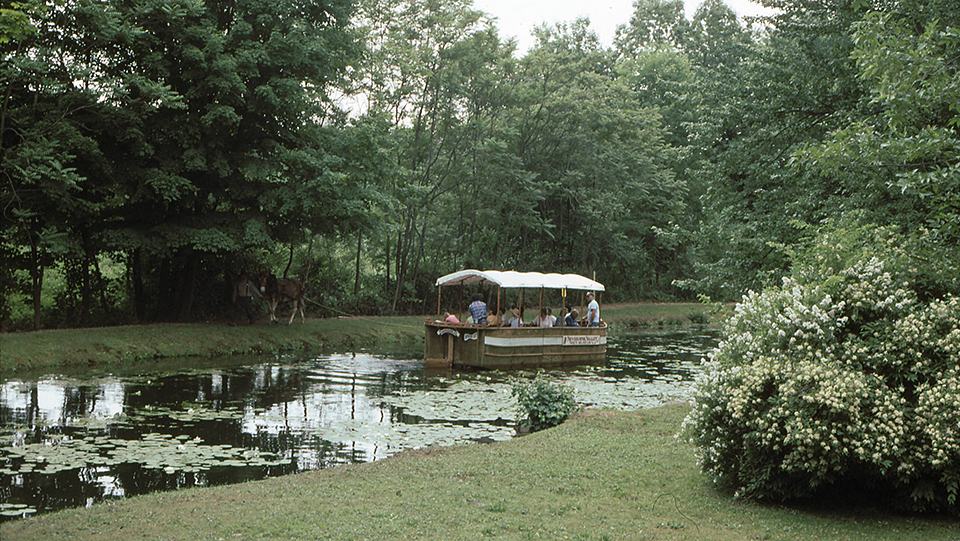
Photo: The Morris Canal at Waterloo Village, 1998, Chuck Walsh photographer, wikipedia, public domain, accessed June, 2021.
The Morris Canal [1] was one of the few amphibious canals to operate in the United States. Stretching from Phillipsburg on the Delaware River to Jersey City on the Hudson River, the Morris Canal opened up the coal fields of eastern Pennsylvania to the industrial northeast of the United States.
The canal route runs through the counties (west to east) of Warren, Sussex, Morris, Passaic, Essex and Hudson. The straight line distance between Phillipsburg and Jersey City is only sixty miles, yet the overall distance covered by the course of the canal amounted to 106.69 miles. The increasingly rugged terrain encountered along the chosen route forced the canal to meander considerably along its path connecting the two rivers.
George P. M'Culloch, president of the Morris County Agricultural Society in 1820, is generally credited with originating the idea of linking the Hudson River with the Delaware River by a canal across the upper tier of the State of New Jersey.
Designed to unite the interests of New Jersey, Pennsylvania and New York, the Morris Canal was primarily intended to provide access to the anthracite fields of Pennsylvania's Lehigh Valley. Pennsylvania would profit by the acquisition of a direct water route to the markets for hard coal then developing in New Jersey and New York. The languishing iron industry of northern New Jersey would be revived by the availability of a new fuel supply and the farmers of the region would have an improved transportation system to aid in the importing of fertilizers and the exporting of produce. New York and New Jersey would both be able to develop new manufacturing and industrial plants as soon as the completion of the canal could guarantee a steady supply of hard coal. In the summer of 1820 M'Culloch launched a highly successful publicity campaign for his projected canal in the leading newspapers of northern New Jersey. M'Culloch's campaign culminated in the New Jersey Legislature's chartering of the Morris Canal and Banking Company as a private corporation on December 29, 1824.
The canal charter authorized the issuing of $1,000,000 in stock (par value, $100 per share) to be used for construction purposes. The company was also granted permission to print and issue its own currency to be used for payments of toll charges on the canal. The charter also provided for the issuing of an additional $1,000,000 stock for banking purposes. This liberal concession, offered in a decade famous for its "bank mania," ultimately proved detrimental to the best interests of the canal. When the company's subscription books were opened at Jersey City on April 26, 1825, the entire issue was at once over-subscribed. Speculators swelled the ranks of the investors. Within two years, forfeiture of stock and corruption of many of its directors almost caused the dissolution of the Company.
On October 15, 1825, ground was broken at the summit level — Great Pond (now Lake Hopatcong) and considerable festivity marked the ceremony. Cadwallader D. Colden, ex-mayor of New York City and then president of the Morris Canal and Banking Company, outlined plans for the future waterway. Designed to connect Newark, on the Passaic River, with Phillipsburg, on the Delaware River, the Morris Canal would of necessity traverse some of the rougher terrain in the State.
The speed of the work went forward quickly. By 1828, eighty-two of the canal's ninety-seven eastern sections and forty-three or its seventy-four western sections were finished. A temporary lack of funds retarded construction in 1829, but several short stretches of the canal were completed and opened for traffic that year. Thirty-eight miles of the waterway, from Newark in Essex County, to Rockaway in Morris County, were opened to trade in 1830. By the spring of 1831 the Morris Canal was open for through navigation from Phillipsburg to Newark, a distance, on the waterway, of 98.72 miles. The cost was $2,104,413.
Phillipsburg, situated on the New Jersey bank of the Delaware River, was a logical choice for the western terminus of the canal. The town, directly opposite the coal-rich Lehigh Valley of eastern Pennsylvania, retained this function throughout the history of the canal. In 1836, Jersey City replaced Newark as the eastern terminal when an eight-mile extension of the waterway was completed connecting Newark with "Jan the Laugher's Point" (near present-day Washington and Dudley Streets), on the New Jersey bank of the Hudson River.
The Morris Canal lifted boats from the Delaware River at Phillipsburg to 913 feet above sea level at Great Pond (Lake Hopatcong), a total ascent of 758 feet. From the summit level at Great Pond the boats descended 913 feet to sea level on the Hudson River. The combined ascent and descent encountered in a complete one-way trip amounted to 1,672 feet. The amount of vertical movement required in a trip over the canal between Phillipsburg and Newark averaged approximately 18 feet per mile. By way of comparison New York's Erie Canal averaged less than one foot of vertical movement per mile.
The major physical difficulty inherent in the construction of the Morris Canal was the surmounting of vast differences in elevation. A conventional type of canal would have required on average the construction of one lock every two miles. The cost of such a canal would have been prohibitive. As early as 1822 M'Culloch engaged Professor James Renwick, of Columbia University, to find a solution to lifting in the canal. Professor Renwick's solution was an ancient one. He advocated the installation of inclined planes in locations unsuited to locks.
The Morris Canal, due to its extensive use of inclined planes, became one of the few amphibious waterways ever constructed in America. The eastern division of the canal. (i.e. east of Great Pond (Lake Hopatcong) consisted of twelve inclined planes with a combined lift of 750 feet, and sixteen locks with a combined lift of 164 feet. The western division consisted of eleven inclined planes with a combined lift of 690 feet, and seven locks with a combined lift of 68 feet.
The most exceptional of the twenty-three inclined planes in the Morris Canal was located near Lopatcong, (close to present-day Stewartsville) in Warren County. It had an overall rise of 100 feet and length of 1,600 feet. Twelve minutes were required for a one-way trip on this particular plane. The remaining planes along the route rose on an average of 62-1/2 feet with length varying from 500 to 1,500 feet. The average grade encountered on the planes was the inclined planes on the Morris Canal operated in a very simple fashion. A set of tracks, having a gauge of 12-1/2 feet, ran from the bed of the canal up the incline, over the brow of the hill and into the next stretch of canal bed. The tracks were submerged in both the upper and lower levels of the canal bed, being exposed only along the plane proper. A large cradle, capable of holding a canal boat, rode upon the tracks of the plane. When the cradle was admitted into the canal a boat was floated into the cradle and secured. Power to haul the cradle and its burden up the inclined plane was supplied by a cast iron water wheel (or Scotch turbines) operating on the reaction principle. These turbines operated like large lawn sprinklers and the pressure of the water balanced the weight of the wheel, the shaft, and the gear, and relieved the friction on the bearings. The water wheel ultimately activated a drum upon which chains attached to either end of the cradle wound up at one end and unwound at the other as the cradle and its burden were hauled up the incline.
The Legislature Committee on railroads and Canals made a trip over the Morris Canal in the summer of 1912. On their return a statement was issued asserting that, "...from Jersey City to Paterson it was little more than an open sewer...but its value beyond Paterson was of great importance, no longer as a freight transit line but as a parkway." In 1922 all canal properties, except those in Phillipsburg and Jersey City, and water rights were transferred to the State of New Jersey. On March 12, 1924 the Legislature adopted an act providing for the drainage of the Morris Canal. That spring the canal was drained. Some sections of the canal bed were later converted to more modern transportation uses. For instance, in Newark, the City Subway had thundered along the old canal bed since the 1930's, while overhead a wide strip of pavement, Raymond Boulevard, marks the original route of the canal through a part of the city. A plaque affixed to the Kresge Department Store Building on the north side of Raymond Boulevard, at Broad Street, marks the vanished route of New Jersey's longest artificial waterway in the city of Newark.
- Dan Clement, 1983, Historic American Engineering Survey, Morris Canal, [HAER NJ-29] memory.loc.gov, accessed August, 2013.