
The Ashton Heights[†] neighborhood of Arlington County, Virginia is significant as a planned suburb of Washington, D.C. The growth of this historic community is tied to the arrival of the commuter railroads in Arlington County during the early 20* century and the housing needs of government employees. Developed in 1921, Ashton Heights was the first neighborhood in Arlington County platted by Ashton Jones, a speculative developer from southern Virginia. The community developed over several decades between 1921 and 1950, under the direction of the George H. Rucker & Company. A total of twenty-three separate divisions make up Ashton Heights, with eighteen different developers.' Restricted to white middle-class families, Ashton Heights became home to many Washington D.C. residents looking to move out of the nation's capital. It became a convenient locale for many federal government workers due to the availability of public transportation to and fi-om the nation's capital. Architecturally, the community features a number of early-20*'century buildings that reflect the fashionable styles and building forms of the period. Surrounded now by major transportation and commercial corridors, Ashton Heights retains a substantial number of early-20th century dwellings and apartment buildings representing popular styles and forms including the Bungalow/Craftsman, Cape Cod, Colonial Revival, American Foursquare, Tudor Revival styles and a single example of the Gothic Revival style. Civic, religious, and educational structures, as well as low-rise commercial buildings, and a cemetery support the residential community.
The Ashton Heights Historic District has a period of significance extending from 1900 to 1950 and reflects the themes of architecture and community planning/development. In all, there are 1,100 contributing resources, and 162 non-contributing resources within the Ashton Heights Historic District. The community consists today of 781 properties with a total of 1,262 buildings, sites, and structures. Located within the Historic District, the Clarendon (Matthew Maury) School is listed individually on the National Register ofHistoric Places.
Ashton Heights is a planned community that developed because of its attraction to the expanding middle- and upper-middleclass population of Washington, D.C. in the second quarter of the 20th century. The Washington and Old Dominion Electric Railway, which ran fi-om Rosslyn to Fairfax traveled parallel along the road that eventually became Fairfax Drive. Part of the Southern Railway's Bluemont Branch extended through the growing commercial enclave at Clarendon by 1912. The arrival of the streetcar lines prompted the transformation of Ashton Heights from its rural setting to its present status as one of central Arlington County's residential neighborhood. The increasing acceptance of the automobile and the need for efficient transportation routes into the District of Columbia dictated the 1932 construction of the Memorial Bridge, the opening of the George Washington Memorial Highway, and the ultimate demise of the railway. Surrounded by major automobile thoroughfares, Ashton Heights was firmly established as a commuting suburb of Washington, D.C. by 1950.
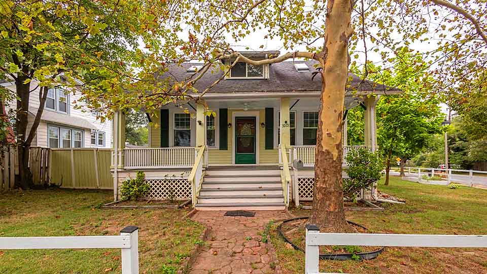
The suburban neighborhood of Ashton Heights is substantial concentration of domestic architecture, representing the Queen Anne, Gothic Revival, Colonial Revival, Craftsman, and Tudor Revival styles that were popular during the first half of the 20th century. Local builders and architects, including Frederick E. Westenberger and M.T. Broyhill, speculatively designed the majority of the residences according to the restrictions established by developer Ashton Jones. These restrictions concerned the race of residents, builders, and minimum construction limits, and required approval fi-om Rucker Realty of any proposed building plan or specification. The earliest houses erected within the original Ashton Heights subdivision were Craftsman-, Colonial Revival- and Tudor Revival-style residences built for middle-class residents. Set back from the street, these larger dwellings were augmented by sim porches, side wings, rear ells, and garages.
The dwellings of the second quarter of the 20th century are similar m style to the earlier dwellings, using essentially Colonial Revival-style elements. Much of the difFerence between the earlier houses and the later dwellings rests primarily in the level of ornament, the later being much more modest in detail. Many of the houses fi-om the second quarter of the 20* century are of brick construction, and are either one-and-a-half or two stories in height and typically three bays wide. Large-scale multiple-family housing was built during the later 1930s and early 1940s. A large number of apartment buildings, constructed just south of Wilson Boulevard, maintain the Colonial Revival style dominant in the area, except in a much less adorned manner.
The influx of residents in the northern and western sections of Ashton Heights at that time provided a setting for commercial zoning in the area. The commercial enclave constructed during the 1940s is an extension of the commercial development of Clarendon, east along Wilson Avenue. Commercial development along Glebe Road served the needs of the residents of Buckingham Village, a large garden apartment complex between North Oxford Street and Glebe Road.
A significant feature of Ashton Heights is the Columbia Gardens Cemetery, platted in 1917. The cemetery covers over fifteen acres and contains over a thousand graves. It is significant as an example of a rural cemetery design in Arlington County.
The area today known as Ashton Heights was originally a portion of "Brookdale," a 425-acre tract of land patented by James Robertson in 1742. After changing ownership several times, Brookdale was acquired by Lieutenant Bushrod Washington Hunter in 1851. The Hunter family, which possessed significant land holdings in Northern Virginia at the time, is better known for its association with Abingdon plantation, which once stood on the present site of National Airport. Bom in 1807, Bushrod Hunter was the son of Nathaniel Chapman Hunter and Sarah Ann Tyler. He married Mary Frances Blow in 1838 and half a century later, he passed away leaving his land to his eldest daughter, Fannie Blow Hunter.
Residential development in the area around Clarendon, from which Ashton Heights began to emerge, started in 1897, when Bostonian Robert Treat Paine, Jr. purchased twenty-five acres of land near the intersection of what was then the Falls Church-Georgetown Road (now Wilson Boulevard) and the Washington, Arlington & Falls Church Electric Railway line (today the path of Washington Boulevard). In 1900, Paine had the property platted as "Clarendon," which consisted of four north-south streets and one east-west street. The new subdivision was named in honor of the Earl of Clarendon (1609-1674), and the formal dedication was held on March 31, 1900.
Paine employed Wood, Harmon and Company of Washington, D.C. to advertise and sell the building lots. An advertisement for the new suburb emphasized Clarendon's natural features, hs accessibility to Washington, D.C, and the advantages of home ownership in the suburb, a common theme throughout the next three decades.'^ Officially known as the Village of Clarendon, the area grew so rapidly that by 1907 several additions had been subdivided and developed to meet housing and commercial needs. This included "Lyon's Addition to Clarendon" m 1904, "George Rucker's Addition" in 1906, "Moore's Addition to Clarendon" and "Porters Addition to Clarendon " in 1907, "Clement's Addition to Clarendon" in 1908, and "Lattemer's Addition to Clarendon" in 1909. Six more additions to Clarendon were made between March and November of 1910. With the influx of residents, commercial and public facilities began to appear along the streetcar line and along Wilson Boulevard.
Seeking refuge from the nation's capital, many Washingtonians began moving out to the more rural landscape that was to become Arlington County by the tvum of the 20th century. The rash of residents to the area required the installation of amenities, new roads, and public transportation. The Great Falls and Old Dominion Railroad, organized in January 1900, established a streetcar line in 1906 from Rosslyn to Great Falls (along present-day Lee Highway) that conveniently was connected to a line that went into Washington, D.C. A second line was laid fi"om Rosslyn to Fairfax, running parallel along the road that was eventually known as Fairfax Drive, through Clarendon. Part of the Southern Railway's Bluemont Branch, this second line first traveled through Arlington County under the organization of the Washington & Old Dominion Railway in 1912. The arrival of the streetcar lines began the transformation of Clarendon from its rural setting to its present status as central Arlington County's social and commercial center. A substantial number of local developers and builders, like Robert Treat Paine, Jr. before them, recognized the economic prosperity and residential possibilities in Arlington County and began to subdivide the area, creating neighborhoods supported by small local commercial enterprises.
In 1914, a county ordinance mandating approval of new subdivisions by the county engineer was passed by Arlington County. The next county ordinance concerning subdivision control was in April 1930. This ordinance established basic categories for land use.'^ Between 1921, when Ashton Heights was subdivided, and 1930 this new neighborhood was not under much county government control. Many of the decisions regarding its platting, design, aesthetics, and residential character were left up to the real estate agents and builders.
In 1920, the Clarendon Citizens Association, which had been aggressively promoting the area since its formation in 1912, applied to the state to incorporate the area as an independent town. After two years of ensuing court battles, the Virginia Supreme Court denied the request stating that Arlington was a "continuous, contiguous and homogenous community which could not have cities or towns incorporated within it." Despite this defeat, the Clarendon area continued to prosper, surrounded by new residential subdivisions developing through the 1920s and into the 1930s. The three most successful of these neighboring subdivisions—Lyon Village, Lyon Park, and Ashton Heights—still retain their character as individual residential communities today.
Ashton Heights was platted and subdivided in 1921 by Ashton C. Jones, who had acquired approximately sixty-one acres of land in 1919 from Fannie Blow Hunter. The original plat of Ashton Heights was smaller than the present neighborhood, consisting of an area bounded roughly by North Irving Street on the east, 5* Street North on the north, on the west by North Nelson Street, and on the south by the northern edge of Columbia Gardens Cemetery and 2"** Street North. The neighborhood combined two previously platted subdivisions, namely Ashton Jones's Addition to Clarendon (the section north of Pershing Drive) and Moore's Fourth Addition to Clarendon (south of Pershing Drive). The Street layout of Ashton Heights consisted of a grid pattern framing Pershing Drive (then Cathcart Avenue), which ran northeast to southwest bisecting the neighborhood. The neighborhood was later expanded on the west to include the area east of North Oakland Street and north of Arlington Boulevard. The northernmost portion of what is today Ashton Heights, north of 5* Street North, began to develop before 1921 as part of Clarendon. These include sections platted by Strickler (1911), Sfraight (1911), Slack (1911), Moyler (1918), Wilson (1919), J.W. Glennan (1919), and Ellen E. Fuss (1920). Jones's second addition further developed Ashton Heights by acquiring fourteen acres of the Ellen Fuss subdivision in 1922. This area consisted of a total of five blocks located between Sixth and Fifth Streets and between Irving and Monroe Streets.
Ashton Jones, bom in 1878, came from a large family in Lunenburg County, Virginia, having nine brothers and sisters. He attended the College of William & Mary for two years and then served as the circulation manager for the Times-Herald in Newport News for three years. Afterwards, he worked in the furniture business for three years. In 1909, Jones moved to Clarendon after marrying Margaret Rucker. Persuaded by his brother-in-law, George H. Rucker, to work in real estate with him, Jones joined Rucker Realty, which was located in Arlington County. Rucker Realty was incorporated in 1906 immediately after George H. Rucker arrived in Clarendon. Soon after his arrival to Clarendon, Jones acquired a position as deputy county court clerk under, Rucker who served as county court clerk. He maintained this position from 1912 to 1919.
Extremely active in the community through his entire life, Ashton Jones was engaged ui a number of positions including political, religious, financial, and social. He served as organizer and chairman of the board for the First Federal Savings and Loan Association and for the Clarendon Trust. He owned and developed subdivisions in the county including Ashton Heights and Lee Heights. Jones also served as deacon for the Baptist Church, president of the Arlington Chamber of Commerce, and was a member of Columbia Lodge, Clarendon Lodge, and Fraternal Americans of Alexandria, Jones continued his partnership with George H. Rucker & Company until his death in 1960.
The George H. Rucker & Company began with Ashton C. Jones, Sr., George Rucker, and N.A. Rees as the original partners. Rucker passed away in the early 1920s and left his third of the partnership to his daughter and her husband, Rees. During the late 1930s, Rees died and Jones bought his third of the company from Rucker's daughter. This gave Jones the majority ownership with two-thirds of the company.
The George H. Rucker & Company continued to place advertisements in the Arlington County directories from 1915 to 1955. First, the advertisement illustrated a Cape Cod dwelling, which housed the firm, and then an advertisement with a statement of guarantee. "Rucker Realty will give your house a good home was their motto in 1974.'^ The George H. Rucker & Company is still in business today with an office in McLean, Virginia.
Ashton Heights is an excellent representation of community development directed singularly towards Anglo-American middle-class families. Interestingly, many of the builders were given minimum income and racial restrictions in their contracts. Because of its accessibility to Washington, D.C, its desirable suburban lots, and its proximity to the commercial and civic facilities of Clarendon, Ashton Heights grew steadily after its establishment in 1921. Advertisements in newspapers claimed that Ashton Heights was only three miles from Washington and twenty-two minutes by Streetcar. In order to guarantee the type of neighborhood the agents and builders wanted for Ashton Heights, restrictions were incorporated into many of the deeds contracted at the time. There were racial, financial, commercial, and aesthetic restrictions applied to many of the deeds, between 1921 and 1930. These restrictions prohibited non-Caucasians from owning renting, or occupying the dwellings in the neighborhood. A minimum construction cost was placed on many of the units to ensure that only members of the middle to upper-middle class would reside in Ashton Heights. This minimum construction cost normally ranged from $4,000 to $6,000. The average annual income of many of the r^idents buying in Ashton Heights during the 1920s was $2,300. The cost of a lot and house at that time ranged from about $5,500 to approximately $9,000.
The neighborhood was promoted in advertisements as having Streets, sidewalks, magnificent shade frees, and electricity for the low price of ten cents per square foot. By 1925, thirty-four houses had been erected in the expanded Ashton Heights. The houses consisted of mainly woodframe bungalows and vernacular dwellings. During the early years of its development, a common building practice among Ashton Heights residents was to erect a small shed at the rear of a lot in which the family lived until the main dwelling was finished. These sheds were then converted to utilitarian structures when the family moved into the completed main dwelling.
Another restriction given by Ashton Jones prohibited the sale of alcoholic beverages or the "establishment of any business considered a nuisance." In addition to these standards, the number of houses built on a single lot was restricted and a minimum set back distance between a building and the Street was established. In developing Ashton Heights, Jones mandated required approval from George H. Rucker & Company of any proposed building plan or specification
Ashton Heights grew to include numerous additions by builders other than Ashton Jones. These builders prescribed to Jones's restrictions of minimum income and race. Additions included those platted by Kay-Alger Company (1922), M.W. Bowen (1925), Robert R. Dye's Section 1 and 2 (1929 and 1933), and Section 1 of Crack's addition (1932). One other subdivision not originally a part of Ashton Heights, platted by Ball and Douglas, was an addition to South Ballston that developed in 1925
In a 1928 publication, The Book of Arlington County, Virginia, Ashton Heights is noted on a map showing the railway lines, highways, and high schools of the area. Yet, a 1930 map of Arlington County, which noted the location of its chief subdivisions and roads, did not include Ashton Heights. Other subdivisions plotted on this map include Lyon Park, Clarendon, Ballston, and Cherrydale to name a few.
The high influx of residents moving to Ashton Heights and commuting to Washington, D.C. follows the trend set in the adjacent neighborhoods such as Clarendon, Lyon Park, and Lyon Village. Polk's Directory of 1927-1928 only lists approximately 150 people, half of the area's population, and in some cases, their occupations were noted, in addition to the names of their respective wives. Many of the occupations listed were federal government positions. Twenty clerks were listed working for various departments including War, Treasury, Post Office, Navy, and Interior. Two attorneys were listed, one working for the Interstate Commerce Commission. The Patent Office and the Department of Commerce had a few employees residing in Ashton Heights. Other occupations listed in the directory included carpenter, realtor, builder, weather striper, artist, nurse, salesman, printer, welder, and librarian.^" By 1928, Ashton Heights had grown to a population of approximately 300 people. At that time, Hugh McGrath served as president of Ashton Heights Citizens Association. The Women's Club of Ashton Heights was headed by Hazel Davies.
A sampling of the 1930 census supports the information given in Polk's Directory. For the neighborhood of Ashton Heights, the United States government was the predominant employer. The neighborhood was comprised of all Anglo-American residents and ranged in ages from early twenties to retirement age. The residents were native to a variety of states including Rhode Island, New York, Missouri, West Virginia, Illinois, Pennsylvania, Virginia, Oklahoma, Ohio, and California. No one state was the dominant place of origin. It also appears that with many of the families in this 1930 sample the parents came from outside of the immediate metropolitan area and the children were bom in the District of Columbia. In addition to the occupations listed in Polk's Directory, others include soil scientist, freight agent for the railroad, bookkeeper, police officer, and store manager.
Thirty-eight churches were located in Arlington County by 1924, eleven of which were Methodist churches. One of the eleven was the Clarendon United Methodist Church, presently located at 6* Street North and North Irving Street. It had its start after the tum of the 20 century in the North Hemdon Street home of William H. Overal. In 1906, with the help of Reverend Ballengee of Georgetown's Calvary Methodist Episcopal Church, the congregation moved into its new home at North Jackson and North Irving Streets. It was not until 1910 that the church received its first full-time fully ordained minister. Dr. Theodore M. Swan. The congregation decided in the early 1920s to move into a second church at the east comer of North Irving and 10 Streets, presently an apartment building. The land for the present-day Clarendon United Methodist Church was purchased in 1932 and the church was completed by 1941 at 606 North Irving Street. In 1951, the church acquired the Kirkside property and a parking area across Irving Street. Kirkside is a circa 1923 single-family dwelling located at 625 North Ivy Street. It is a Colonial Revival-style hip-roof building clad with stucco with a wood frame garage at the rear of the house. It was in 1951 that the educational building for the Clarendon United Methodist Church was constructed. Kirkside was converted from a single-family dwelling to a young adult center at this time. According to a Virginia Sun article, in 1974, there were approximately 1500 members of the Clarendon United Methodist Church, a decline from previous years. The pastor indicated this decrease was due to the number of apartment dwellers in the area.
Other churches in and surrounding the Ashton Heights community include the Clarendon First Baptist Church, Trinity Chapel, Clarendon Presbyterian Church, and Clarendon Catholic Church, Arlington Boulevard became an important thoroughfare for the location of religious buildings due to their high visibility to passersby. For example, between 1936 and 1954, the Faith Lutheran Church with its education building, and the Arlington Church of Christ (formerly the 2" Church of Christ Scientist) at the comer of N. Irving Street, were constructed within two blocks of one another along Arlington Boulevard.
To meet the needs of the growing population in Arlington County, the Clarendon School was constructed in 1910. An undeveloped two-acre lot of land at the intersection of Wilson Boulevard and North Monroe Street was purchased in July 1909 for the sum of $1,800 from Edward A. and Martha I. Wilson of Indian Lake, New York. Charles M, Robinson of Richmond, Virginia, won the contract to design the school and M.W. Gayle of Newport News, Virginia, served as the builder. During his career, Robinson (1867-1932) gained notoriety statewide as a school architect. Scholastic commissions included buildings for James Madison University, Radford University, the College of William and Mary, and Virginia State University. The architect was also responsible for the designs of numerous elementary and high school buildings throughout Virginia between 1907 and 1935, particularly in Richmond and Norfolk.^^
The Clarendon School, constructed in a Classical Revival style in 1910, served as the sole elementary school for the surrounding area for sixty-three years. It provided instruction to grades one through six. The name was changed to Matthew Maury School in 1924. In 1973, the Clarendon School ceased to function as a public education facility and, in 1977, the building was rehabilitated to serve as the Arlington Arts Center. The Clarendon School survives as the second oldest extant school building in Arlington County and was listed on the National Register of Historic Places in 1999.
As the community developed, civic groups began to organize and, in 1924, the Women's Club of Ashton Heights was formed. Ashton Jones donated a lot and helped the fledgling organization acquire a loan to build its clubhouse at 413 North Irving Street. Ashton Jones controlled seven lots on the east side of North Irving between North Pershing Drive and 5* Street North. After donating one lot to the women's club, he formed his addition to Lyon Park. Lyon Park, developed by Frank Lyon, was in the course of being subdivided during the same period as Ashton Heights. A neighborhood contractor was hired for $4,700 to erect the building that was designed by Hazel L. Davies.^* To help pay for the mortgage, the Women's Club held bake sales, dinners, and card parties and rented out the building to various groups. Especially popular during the early thirties were the dances held by many different fraternaties and sororities of nearby universities.^^ In 1945, the final mortgage payment was made and the club devoted its time to community affairs. Over the years, the Women's Club organized numerous fundraising drives for neighborhood improvements and hosted educational and entertainment programs for the community.
One of the most prominent features of Ashton Heights is the Columbia Gardens Cemetery. Located at the southern boundary of the district, it displays the 20th-century landscape design principles influenced by the rural cemetery movement of the late 19th-century. With the rapid growth of urban centers late in the 19* century, landscape design and city planning began to slowly merge with the mid-century fashion for the "picturesque" work of designers such as Frederick Law Olmsted. The historic relationship of the cemetery and this principle of creating rural landscape design within urban centers is well documented in Park and Cemetery, one of the earliest professional journals in the field of landscape architecture. By the 1900s, parks and cemeteries began to take on more formal aspects of landscape planning, a school of thought that was made fashionable by the City Beautiful movement. With the reintroduction of classical formality early in the 20* century, cemetery landscapes tended to have axial aligned principal avenues that focused on more imposing resources such as churches.
The Columbia Gardens Cemetery is an example of the more rural cemetery design, however, with its winding roads and natural landscape features. The cemetery is maintained by the Alexandria Park Association, which was incorporated in 1914 in Huntington, West Virginia, the home of the principal founder Julius Broh. The president of the association was Colonel Robert Dye, the former superintendent of the Arlington National Cemetery. Having won approval from the Arlington County Board of Commission, the association platted the cemetery in 1917. The proposal indicated their intent to "make a place that will be attractive as a park and a credit to the county." The "park" initially encompassed nearly thirty-eight adjoining acres, with an option to purchase an additional thirty acres. In November 1917, the board of directors employed a landscape architect from Cleveland, Ohio, a Mr. Jenney, to prepare the design, specifications, and methods of procedure for operating a cemetery. The advertisement in Hills 1955 Directory for Columbia Gardens Cemetery claims it is a "shrine of perpetual beauty" with "perpetual care."^" One of the more significant interments is Francis Eugene Worley (1908-1974). He served as a member of the Texas State House of Representatives, 1935-1940; U.S. Representative from Texas, 1941-1950; and as Judge of U.S. Court of Customs and Patent Appeals, 1950-1959. Another politician buried in Columbia Gardens is Charles Noel Crosby (1876-1951). He was a Pennsylvanian Democrat in the U.S. House ofRepresentatives from 1933 to 1939. A mausoleum in honor of Admiral George Dewey (1837-1917), the famous American naval officer, is located near the entrance of the cemetery.
In 1930, Ashton Jones gave a statement advocating the sewerage bond issue that was introduced to install a modern sewer system into Arlington County. This statement foresaw the importance of modern utilities for Arlingtonians. Concerned with the development of the county, he stated that a modern sewerage system would induce "far more people [to] move in, which will increase employment permanently." Ashton Jones foresaw the building boom in Arlington County with his final statement on the bond issue: "the sewerage and the school bond issues.. .coupled with the completion of the New Memorial Bridge, will mean the greatest building boom this county has seen since the days before the Great World War." He did not realize that in actuality the Second World War would bring about the largest building boom the county would ever see.
Subdivisions to Ashton Heights during this era included Langhome (1931), Alice Indemauer property (1937), Mrs. Tyrell Property (1937), Kenmore (1938), Van Every (1939), and Crack (1949). Several individual builders were responsible for their own speculative building throughout Ashton Heights. Frederick E. Westenberger is one of several individual builders given restrictions from Ashton Jones. He served as developer for many of the brick dwellings constructed between 1933 and 1940 in Ashton Heights. Westenberger was a German immigrant who worked in Norfolk as a carpenter before moving to Arlington. Westenberger began building just one or two houses at a time, but eventually produced between ten to fifteen houses at once. Some of Westenberger's houses include 325, 415, 419, and 423 North Oakland Street; 435, 436, 507, and 601 North Monroe Street; and numerous houses in the 400 block of North Nelson Street. Westenberger was also a popular builder in the Lyon Village neighborhood, having built 23 houses for that community including his own residence. All of the bricks were made by hand on a wood press in Glasgow, Virginia. Although the overall designs of the residences produced by Westenberger were similar, each dwelling was given an individual characteristic, such as a recessed window, fluted columns, a copper-roofed portico, or wood shingling. Kenton D. Hamaker, an associate architect with the Clarendon firm of Ernest Dorsey Stevens, in 1935 designed many of the architectural plans initiated by Westenberger.
Another set of builders in Ashton Heights were the Broyhill brothers; Marvin T. served as the developer, and Lincoln R. worked as the carpenter. Bom in Wilkes County, North Carolina, Marvin T. Broyhill attended business school in Cincinnati, Ohio and Omaha Technical School in Nebraska. In 1912, he worked for the Southern Railroad Company as a telegraph operator and shipping clerk. In 1915, he formed the Virginia Real Estate Association, and eventually moved to Arlington in 1937. He located the M.T. Bro>iiill and Sons Corporation at 4600 Lee Highway. A number of houses in the Alice Indermauer tract in Ashton Heights were built by the M.T. Broyhill and Sons Corporation. Some of these houses include 514, 520, 524, 530, 538, and 544 North Monroe Street. Having constructed over 15,000 houses in Northern Virginia immediately following World War H, the Broyhill Corporation grew to be one of the largest real estate companies in the Washington area.
Walter J. England was another one of these individual speculative builders. He constructed a number of houses along North Jackson Street, including 204 and his own house at 206. England built smaller less expensive houses, one of which sold for only $2,500 in the 1930s. Another such builder in Ashton Heights was Clarence Gosnell, who built a large number of duplexes in 1938 in the Kenmore subdivision along Oakland Street. Nelson Street was also developed by Gosnell along with O.T. Carr, Inc. in 1939. Builder Joseph L. Gaddy constructed many of the dwellings in Robert R. Dye's Third Addition to Ashton Heights. In 1939, Sixth Road was developed by contractor J.B. Tiffey.
The Kay-Alger Company, a Washington real estate firm, was a significant builder of a small area of Ashton Heights located above l " Street North, below 2"^ Road North, and bordered by Columbia Gardens Cemetery to the west, and Irving Street to the east. This company was selling its lots for twelve cents per square foot with immediate payment, and fourteen cents through monthly payments. Walter England built a few of the Kay-Algers lots, one going for an amount of $1,310 at twelve cents per square foot. The Kay-Alger Company, located in the Bond Building in Washington, D.C, used innovative selling and advertising techniques to promote the new suburbia in Arlington County. Washingtonians were given free auto rides from the Bond Building, leaving on the hour during the week, to the neighborhood for inspection trips. Their advertising for Ashton Heights included such adjectives as "picturesque," "progressive," and "natural beauty.
A 1948 advertisement of a house for sale in Ashton Heights on North Nelson Street leads with "In Popular Ashton Heights." The description of the house is as follows: Beautiful all-brick residence with open fireplace in living room, den or bedroom on first floor, hardwood floors, 3 bedrooms on second and bath, with pull-down stairs to a finished attic. Shower in basement and also paneled recreation room. Oil hot-water heat, 2 electric refrigerators, Venetian blinds, 2-car det. Garage. 3- blocks of Buckingham Shopping Center, close to parochial and public schools, 1 block to bus transportation. Possession with title. Act quick.
The Great Depression suppressed the extensive building rate that had occurred in the Washington, D.C area during the 1920s. The early thirties were a difficult time, economically for the entire nation that is why there were only sixteen houses built in Ashton Heights north of Pershing Road between 1931 and 1933.
Ashton Heights is a residential neighborhood with some commercial infringement, or rather support, at the northern edge along Wilson Boulevard. Most of the commercial buildings were primarily constructed during the second half of the 20* century. By 1938, only a few lots were zoned commercial in Ashton Heights, and one lot was zoned for industrial uses. The commercial corridor includes restaurants, gas stations, and numerous other retail establishments that service the Ashton Heights community and the automobile traffic passing to the north of the neighborhood.
The explosion of the population in the Washington, D.C. metropolitan area between 1934 and 1954 as a result of the federal government's New Deal programs, increasing need for wartime workers and return of World War II veterans, led to a crippling housing shortage throughout the area.^* Arlington County, whose rural landscape would soon be an image from the past, became one of the fastest developing counties in the Washington, D.C. metropolitan area." The extensive housing shortage in Washington, D.C. led to the construction of 176 new apartment buildings or complexes in Arlington County between 1934 and 1954 to house these new middle-class residents. During the late 1930s and particularly the war years of the forties, new construction was nearly entirely devoted to the construction of duplexes and multiple-family dwellings, the majority of which was located in the northwestern comer of Ashton Heights. Kenmore Development Company, J.B. Tiffey, Barkley Brothers, Gosnell and Paul Goff, and Crestwood construction Company were some of the builders of this area. During the 1940s, at least 137 multiple-family units were constructed in Ashton Heights.
The number of Arlingtonians continued to grow, with the population reaching 26,615 residents in 1930. This number more than doubled ten years later with a total of 57,040 residents in 1940. Of those employed in 1940, more than 40% were involved with the government on a local, state, and federal basis. These workers, who made up the largest group of families and individuals in need of rental housing, spurred the government to become involved in housing developments. "Increased rentals for...apartment units..., coming in the wake of the largest federal payrolls since the World War (I), were the primary reason for the great revival of.. .building. Thousands of new employees of the New Deal agencies rapidly took up the slack in residential space, causing rentals to increase 25 percent and more."" The Federal Housing Administration (FHA), established in 1934, became the primary mortgage insurers for thousands of residential projects, both single-family and multiple dwellings, throughout the United States. The FHA's involvement in Arlington County directly impacted a number of the large apartment complexes that would be constructed in the county between 1934-1954, The county's location along the banks of the Potomac River across from Washington, D.C. attracted a number of developers with FHA-insured mortgages to construct these large-scale housing projects. Where the FHA was not directly involved, they influenced the designs and layouts of hundreds of the complexes and individual apartments being built in Arlington County. The dramatic increase in population during the 1930s and the limited availability of affordable rental housing for middle-class government workers made the county a prime development area.
The beginning of World War II in Europe in 1939 tumed the FHA's focus to defense housing. In Arlington County, the population jumped from approximately 57,000 in 1940 to 120,000 in 1944. The FHA Large Housing Division tumed its attention to the development of more low rent housing for the burgeoning defense requirements in the metropolitan area and throughout the United States. In order to encourage this type of housing by private developers, the FHA lowered its minimum construction, design and property requirements. Once the United States entered the war in December 1941, low-cost housing for wartime workers was essential, especially in the Washington, D.C. metropolitan area with the severe housing shortages. Changes that were adopted by the FHA to stimulate this development included the omission of service walks, a main exterior entrance and front stairs, the elimination of garages, and the construction of longer buildings.'^ These changes can be seen at the Kenmore Apartments at North Monroe, North Nelson and North Oakland Streets in Ashton Heights, built in 1940. This apartment complex comprises twenty-eight two-story buildings with off-Street parking and individual entrance to each unit. The influence of the FHA suggestions is evident by the elimination of public halls and garage parking at the Kenmore Apartments. The buildings' modest Colonial Revival design and the elimination of expansive garden courts with individual landscaped areas at the rear adhere to the budget cutting items emphasized by the FHA's Large Scale Housing Division.
Ashton Heights is a residential neighborhood with some commercial buildings located at its northern edge along Wilson Boulevard. Most of them were primarily constructed during the second half of the 20th century. By 1938, only a few lots were zoned commercial in Ashton Heights, and one lot was zoned for industrial uses. The commercial corridor includes restaurants, gas stations, and numerous other retail establishments that serve the Ashton Heights community as well as the automobile traffic passing to the north of the neighborhood.
In the 1950s, construction in the area began to decline, as nearly all subdivided lots had been improved. Only seventeen units, all single-family dwellings, were built during this decade. The only apartment complex built since the 1940s, located on Sixth Road North with a total of eight units, was built by the Sharpe and Hamaker Company. There was even less construction during the 1960s and 1970s, with only five and four houses constructed, respectively. As for apartment units, the number jumped from 62 to 446 from the 1960s to the 1980s for the entire neighboring area. This increase is quite indicative of the building boom experienced by the area during the second half of the 20th century.
Although the area experienced a downward trend in the desirability of owning individual homes in the area between the 1960s and mid-1970s, property values have steadily increased and the attraction of the neighborhood has continued to grow throughout the 1980s and 1990s. The coming of the Metrorail in 1974 has also greatly impacted the neighborhood. Two Metrorail stations are located within two blocks of the neighborhood (at Virginia Square and Clarendon), making the area easily accessible to downtown Washington, D.C.
† Adapted from: Kristie Name/titie Baynard, Gerald M. Maready. and Laura V. Trieschmann. Architectural Historians, EHT Traceries, Inc., Ashton Heights Historic District, nomination document, 2002, National Park Service, National Register of Historic Places, Washington, D.C.
Nearby Neighborhoods
Street Names
1st Place North • 1st Road North • 1st Street North • 2nd Street North • 3rd Street North • 4th Street North • 5th Street North • 6th Road North • 6th Street North • 7th Street North • 8th Street North • Arlington Boulevard • Irving Street North • Ivy Street North • Jackson Street North • Kenmore Street North • Lincoln Street North • Monroe Street North • Nelson Street North • Norwood Street North • Oakland Street North • Oxford Street North • Pershing Drive North • Piedmont Street North